> For the complete documentation index, see [llms.txt](https://docs.openmind.com/llms.txt). Markdown versions of documentation pages are available by appending `.md` to page URLs; this page is available as [Markdown](https://docs.openmind.com/full-autonomy-guidelines/features/navigation.md).
# 2D Navigation
Autonomous point-to-point navigation on a saved 2D map.
Once you have a [map](/full-autonomy-guidelines/features/mapping-slam.md), navigation is what makes the robot useful on its own: give it a destination and it plans a path there, drives, and steers around whatever's in the way. Under the hood it's a ROS 2 navigation stack handling planning, obstacle avoidance, and localization on the 2D occupancy grid.
Got ramps or multiple floors? Navigate a point-cloud map with [3D Navigation](/full-autonomy-guidelines/features/3d-map-navigation.md) instead.
There are two APIs involved. You start and stop the navigation stack through the Orchestrator (`:5000`), then send goals and watch their progress through the Navigation API (`:5001`). If you want the robot to stick to fixed paths rather than plan freely, point it at a [route graph](/full-autonomy-guidelines/features/maps-routes-locations.md).
### In the portal
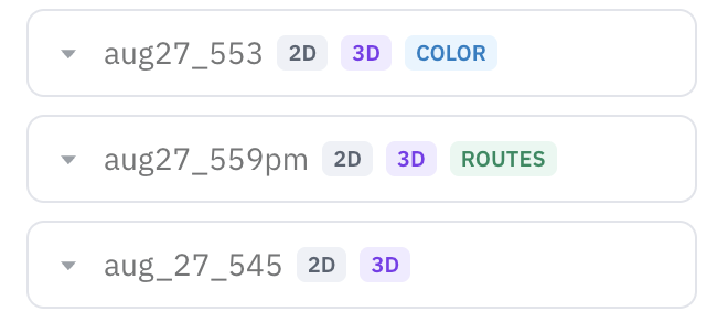
From the [OpenMind portal](https://portal.openmind.com) you can send the robot somewhere by clicking a point on the map (**Set goal**) — no API calls needed. Pick a saved map, and the map view shows the robot's live pose as it drives.
 The **Set goal** tool lives on the shared Map view toolbar, alongside Localize and Clear robot trail — see [Machine Teleops → Map view](/full-autonomy-guidelines/features/machine-teleops.md#map-view).
### Before you start
* You have a **saved 2D map** (from either 2D or 3D SLAM).
* **SLAM is stopped** — navigation and SLAM can't run together.
* If you're using a route graph, it's already saved for that map.
### Driving to a goal
Bring up navigation on the map you want to use:
```bash
curl -X POST http://:5000/start/nav2 \
-H 'Content-Type: application/json' \
-d '{"map_name": "office"}'
```
Add `"route_name": "patrol_route_1"` to constrain it to a route graph.
The robot localizes itself in the map, and you can now send it a goal pose (in the map frame) through the Navigation API:
```bash
curl -X POST http://:5001/api/move_to_pose \
-H 'Content-Type: application/json' \
-d '{"position": {"x": 1.0, "y": 2.0, "z": 0.0},
"orientation": {"x": 0, "y": 0, "z": 0, "w": 1.0}}'
```
That call returns immediately — navigation is asynchronous — so poll for progress:
```bash
curl http://:5001/api/nav2_status
```
Each active goal reports a `status`: `ACCEPTED`, `EXECUTING`, `SUCCEEDED`, `CANCELING`, `CANCELED`, or `ABORTED`. The same API also exposes the live robot pose (`/api/pose`), localization confidence (`/api/amcl_variance`), and the current occupancy grid (`/api/map`) — handy for a dashboard.
When you're done:
```bash
curl -X POST http://:5000/stop/nav2 -H 'Content-Type: application/json' -d '{}'
```
### Parameters
`POST /start/nav2`
| Parameter | Type | Required | Description |
| ------------- | ------ | -------- | -------------------------------------------------------- |
| `map_name` | string | yes | Saved map to navigate on |
| `launch_file` | string | no | Custom navigation launch file (default `nav2_launch.py`) |
| `route_name` | string | no | Route graph for graph-constrained navigation |
`POST /api/move_to_pose` (Navigation API, `:5001`) takes a `position` (`x, y, z` in the map frame) and an `orientation` (quaternion) — both required.
### If something goes wrong
* **`400` on `/start/nav2`** — SLAM is still running, or you left out `map_name`.
* **`400` with a route** — that route graph doesn't exist for the map; [save it](/full-autonomy-guidelines/features/maps-routes-locations.md) first.
* **Goal `ABORTED` right away** — usually poor localization or a blocked path. Check `/api/amcl_variance` and clear the route.
For system endpoints like `GET /status` and base control, see the [Autonomy API Overview](/full-autonomy-guidelines/api_endpoints.md).
---
# Agent Instructions
This documentation is published with GitBook. GitBook is the documentation platform designed so that both humans and AI agents can read, navigate, and reason over technical content effectively. Learn more at gitbook.com.
## Querying This Documentation
If you need additional information that is not directly available in this page, you can query the documentation dynamically by asking a question.
Perform an HTTP GET request on the current page URL with the `ask` query parameter, and the optional `goal` query parameter:
```
GET https://docs.openmind.com/full-autonomy-guidelines/features/navigation.md?ask=&goal=
```
`ask` is the immediate question: it should be specific, self-contained, and written in natural language.
`goal` is optional and describes the broader end goal you are ultimately trying to accomplish on behalf of the user. GitBook uses it to tailor the answer towards what is most useful for that goal.
The response will contain a direct answer to the question and relevant excerpts and sources from the documentation.
Use this mechanism when the answer is not explicitly present in the current page, you need clarification or additional context, or you want to retrieve related documentation sections.
The **Set goal** tool lives on the shared Map view toolbar, alongside Localize and Clear robot trail — see [Machine Teleops → Map view](/full-autonomy-guidelines/features/machine-teleops.md#map-view).
### Before you start
* You have a **saved 2D map** (from either 2D or 3D SLAM).
* **SLAM is stopped** — navigation and SLAM can't run together.
* If you're using a route graph, it's already saved for that map.
### Driving to a goal
Bring up navigation on the map you want to use:
```bash
curl -X POST http://:5000/start/nav2 \
-H 'Content-Type: application/json' \
-d '{"map_name": "office"}'
```
Add `"route_name": "patrol_route_1"` to constrain it to a route graph.
The robot localizes itself in the map, and you can now send it a goal pose (in the map frame) through the Navigation API:
```bash
curl -X POST http://:5001/api/move_to_pose \
-H 'Content-Type: application/json' \
-d '{"position": {"x": 1.0, "y": 2.0, "z": 0.0},
"orientation": {"x": 0, "y": 0, "z": 0, "w": 1.0}}'
```
That call returns immediately — navigation is asynchronous — so poll for progress:
```bash
curl http://:5001/api/nav2_status
```
Each active goal reports a `status`: `ACCEPTED`, `EXECUTING`, `SUCCEEDED`, `CANCELING`, `CANCELED`, or `ABORTED`. The same API also exposes the live robot pose (`/api/pose`), localization confidence (`/api/amcl_variance`), and the current occupancy grid (`/api/map`) — handy for a dashboard.
When you're done:
```bash
curl -X POST http://:5000/stop/nav2 -H 'Content-Type: application/json' -d '{}'
```
### Parameters
`POST /start/nav2`
| Parameter | Type | Required | Description |
| ------------- | ------ | -------- | -------------------------------------------------------- |
| `map_name` | string | yes | Saved map to navigate on |
| `launch_file` | string | no | Custom navigation launch file (default `nav2_launch.py`) |
| `route_name` | string | no | Route graph for graph-constrained navigation |
`POST /api/move_to_pose` (Navigation API, `:5001`) takes a `position` (`x, y, z` in the map frame) and an `orientation` (quaternion) — both required.
### If something goes wrong
* **`400` on `/start/nav2`** — SLAM is still running, or you left out `map_name`.
* **`400` with a route** — that route graph doesn't exist for the map; [save it](/full-autonomy-guidelines/features/maps-routes-locations.md) first.
* **Goal `ABORTED` right away** — usually poor localization or a blocked path. Check `/api/amcl_variance` and clear the route.
For system endpoints like `GET /status` and base control, see the [Autonomy API Overview](/full-autonomy-guidelines/api_endpoints.md).
---
# Agent Instructions
This documentation is published with GitBook. GitBook is the documentation platform designed so that both humans and AI agents can read, navigate, and reason over technical content effectively. Learn more at gitbook.com.
## Querying This Documentation
If you need additional information that is not directly available in this page, you can query the documentation dynamically by asking a question.
Perform an HTTP GET request on the current page URL with the `ask` query parameter, and the optional `goal` query parameter:
```
GET https://docs.openmind.com/full-autonomy-guidelines/features/navigation.md?ask=&goal=
```
`ask` is the immediate question: it should be specific, self-contained, and written in natural language.
`goal` is optional and describes the broader end goal you are ultimately trying to accomplish on behalf of the user. GitBook uses it to tailor the answer towards what is most useful for that goal.
The response will contain a direct answer to the question and relevant excerpts and sources from the documentation.
Use this mechanism when the answer is not explicitly present in the current page, you need clarification or additional context, or you want to retrieve related documentation sections.